Smarter, safer driving using crash location data

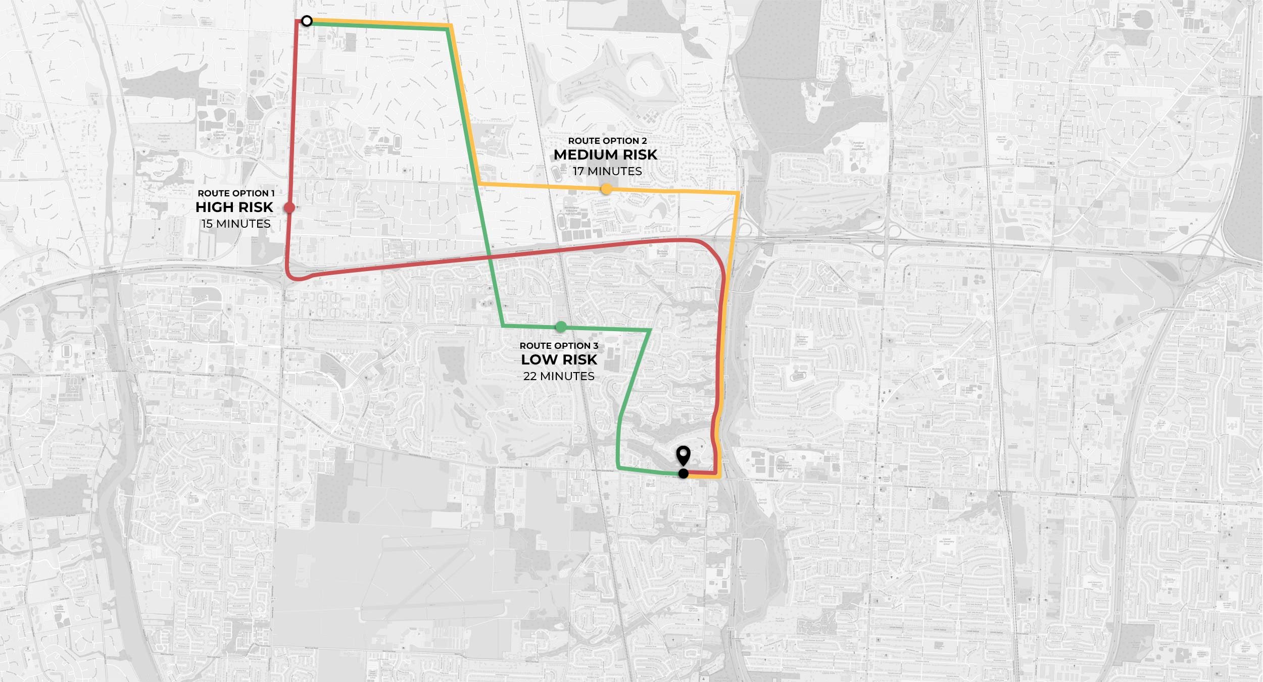
The trade-off between the fastest route and crash risk
A small increase in travel time can significantly improve safety
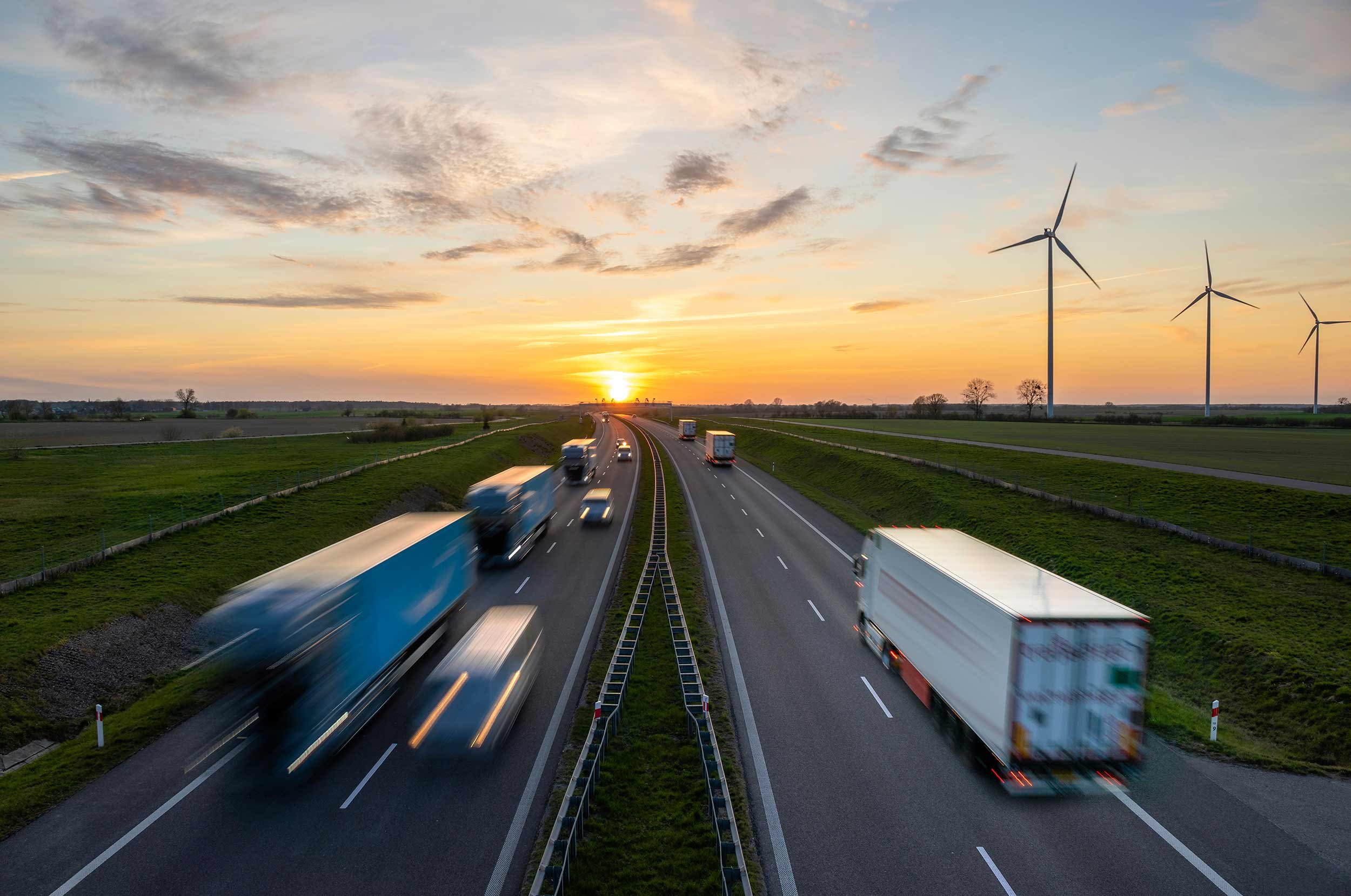
Most drivers today regularly use GPS navigation to get from point A to point B. While navigation apps typically offer the fastest route, this often results in much higher crash risk, according to two separate research studies conducted by civil engineers.
Texas A&M University study: Taking a route to decrease travel time by 8% was associated with a 23% higher risk of being involved in a crash.¹
University of British Columbia study: For the network of roadways included in the study, the safest route tended to be 22% safer than the fastest route, while the fastest route was only 11% faster than the safest route. Just a small increase in travel time can offer considerable gains in safety.²
Even with the current shortage of delivery drivers and pressures to beat the clock, the trade-off for arriving a few minutes earlier is simply not worth the human and financial risk.
Bureau of Labor Statistics: Motor vehicle accidents are the leading cause of work-related deaths in the U.S.³
National Highway Traffic Safety Administration: In 2019, traffic accidents cost the U.S. economy $340 billiondollars.⁴ The cost of one year of crashes killed an estimated 36,500 people, injured 4.5 million others and damaged 23 million vehicles. Traffic accidents are devastating for families and place a large economic burden on society.

Route optimization solutions for last-mile delivery and hotspot warnings for safe-driving apps
The benefits of optimizing routes for safety with a minimal impact on arrival time are quite clear. However, one of the key challenges is gaining access to essential crash rate information at a road segment level. TNEDICCA is a market leader in crash data analytics with the largest national database of geocoded crash location data curated from police reports. Our database includes over 30 million crashes.
We offer last-mile delivery companies more complete route optimization solutions to improve their bottom line with essential data to reduce fuel consumption while lowering loss costs. Our route optimization data considers distance, travel time, fuel consumption and safety. Looking to the future, we can also work with carmakers and companies using autonomous vehicles to offer safer driving routes.
TNEDICCA can also work with auto insurers to improve their safe-driving apps for policyholders by including accident hotspot warnings powered by our crash location data. Notifications empower families to seek safer routes by alerting them of nearby accident hotspots.
1. Soheil Sohrabi and Dominique Lord, “Navigating to safety: Necessity, requirements, and barriers to considering safety in route finding,” Science Direct, April 2022, https://www.sciencedirect.com/science/article/abs/pii/S0968090X21005246
2. University of British Columbia, “New algorithm maps safest routes for city drivers,” ScienceDaily, July 25, 2023, https://www.sciencedaily.com/releases/2023/07/230725172001.htm
3. Bureau of Labor Statistics, National Safety Council Injury Facts, “Safety Topics - Roadway Incidents,” 2022, https://injuryfacts.nsc.org/work/safety-topics/roadway-incidents/
4. National Highway Traffic Safety Administration, “NHTSA: Traffic Crashes Cost America $340 Billion in 2019,” January 10, 2023, https://www.nhtsa.gov/press-releases/traffic-crashes-cost-america-billions-2019#

Use cases
Route optimization for last-mile delivery
A large last-mile delivery fleet incorporates TNEDICCA Road Risk Scores into their navigation system to reduce crashes and improve profitability.

Hotspot warnings for usage-based insurance
A large national auto insurance carrier adds crash hotspot warnings to its safe-driving app to reduce road accidents and lower claim costs.
